Innovative coastal surveying
Here at JBA, we continue to push the boundaries of innovation to deliver smarter, more efficient and sustainable solutions for our clients. Driven and supported by our innovation acceleration programme JBA Labs, we’re seeing some incredible new projects emerge from every area of JBA this year.
One such project by our Marine and Coastal Risk Management (MCRM) team has explored how we can harness in-house equipment and existing technology to find new and smarter ways to monitor coastal change and expand our coastal monitoring services.
Supported by JBA Labs, the MCRM team tested whether large spatial extents of beach and dune topography could be determined from our drone more efficiently and at a lower cost than traditional surveying methods. The project also explored if bathymetry could be extracted from drone video imagery of nearshore propagating waves.
What did we do?
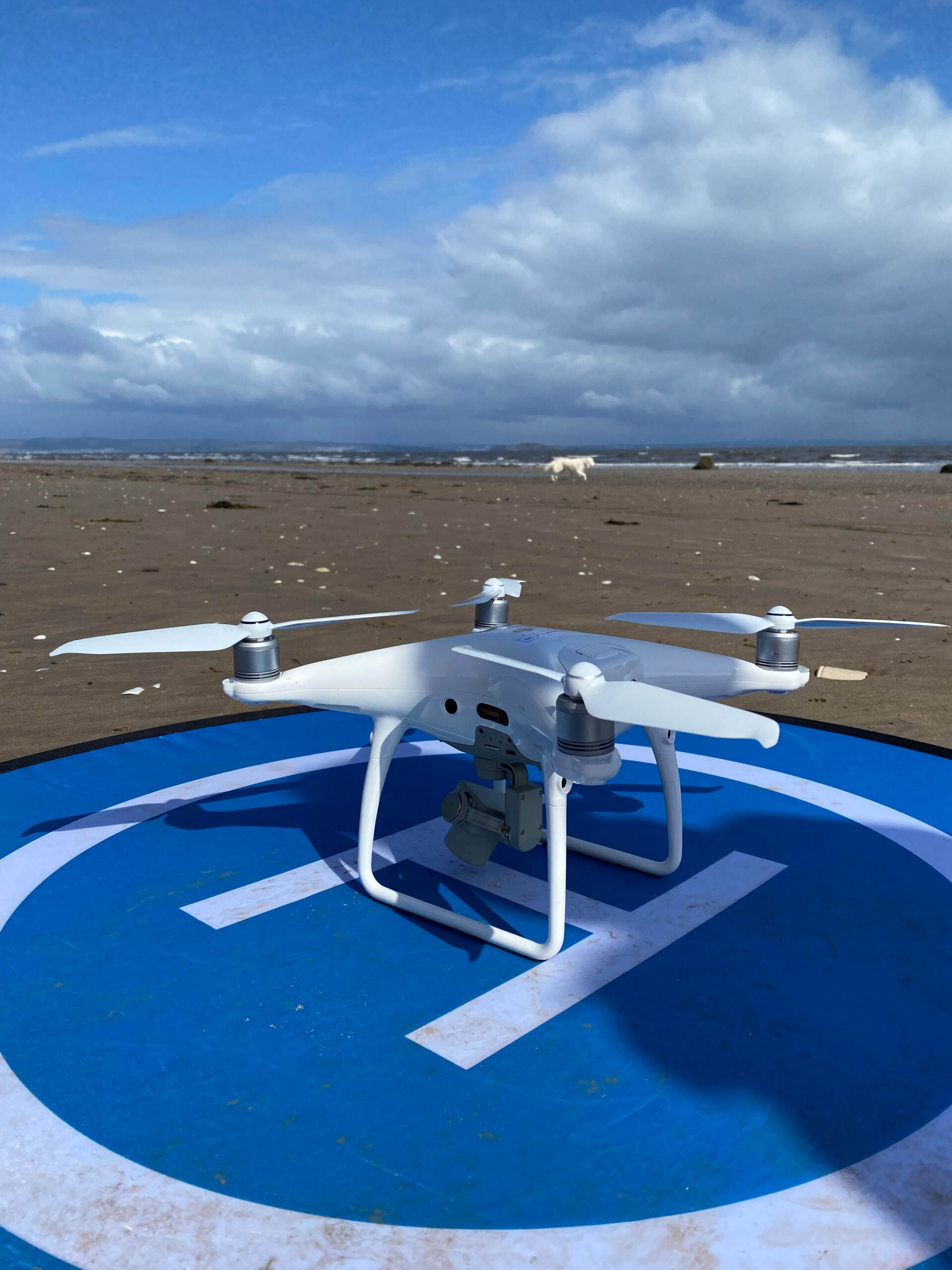
Using an existing JBA drone, the DJI Phantom 4 Pro/Pro+ equipped with a single camera, one of our fully qualified drone pilots flew two types of test surveys. One to acquire beach topography and the other to survey bathymetry along the coastline in Nairn.

Topographic data
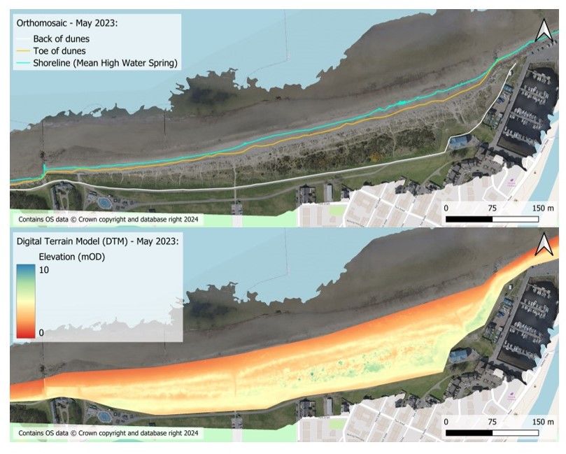
To collect topographic data, we flew the drone over the study area with a downward-looking camera and surveyed Ground Control Points (GCPs) with a GPS-RTK. Using the principles of photogrammetry, Pix4D and Structure from Motion, we were able to create an orthomosaic and to geo-reference the imagery creating a detailed digital surface model (DSM).

Bathymetric data
For bathymetric data, we recorded a 15-30 minute video of near-shore propagating waves holding the drone in a fixed position at an altitude of 45m with the camera facing the incoming waves. Images were geo-rectified using the open-source toolbox from the Coastal Imaging Research Network. We then used the algorithm cBathy (https://github.com/Coastal-Imaging-Research-Network/cBathy-Toolbox) developed by Holman et al. (2013) and updated by Holman and Bergsma (2021), to convert the geo-rectified video imagery into nearshore depth.
Validation
Generating a topographic map of the study area allowed further investigation of dune and beach features and an estimate of alongshore variability.
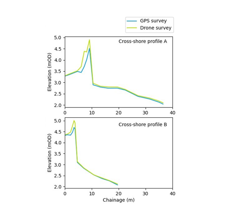
The drone-based topography was validated by carrying out surveys with the GPS-RTK for a range of cross-shore transects to be compared with the drone survey.

Drone-based surveying at Nairn beach, Scotland

Contact Demetra Cristaudo for more information about our coastal monitoring services.
Supporting innovation through JBA Labs
Through JBA Labs we’re accelerating the pace, the efficiency and the scale at which we innovate - delivering for our clients, our business and our people. With a dedicated team of innovation specialists, JBA Labs is here to nurture and support every stage of innovation - from scoping out ideas right through to commercialisation. We help deliver projects at any scale, from creating more efficient processes to developing game-changing innovations.

